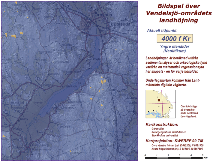
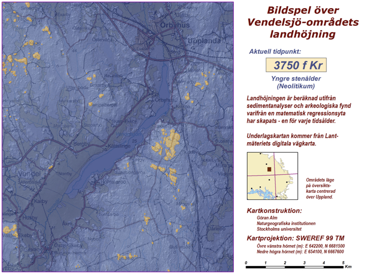
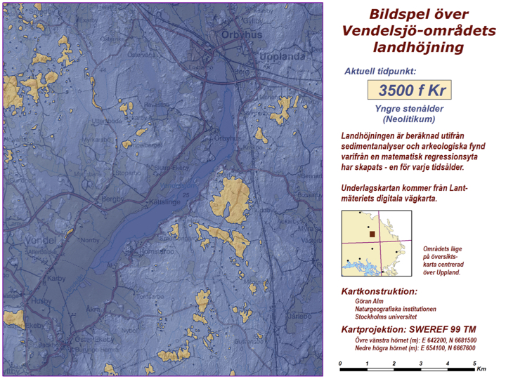
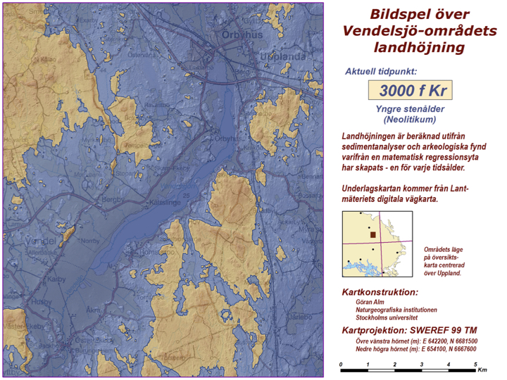
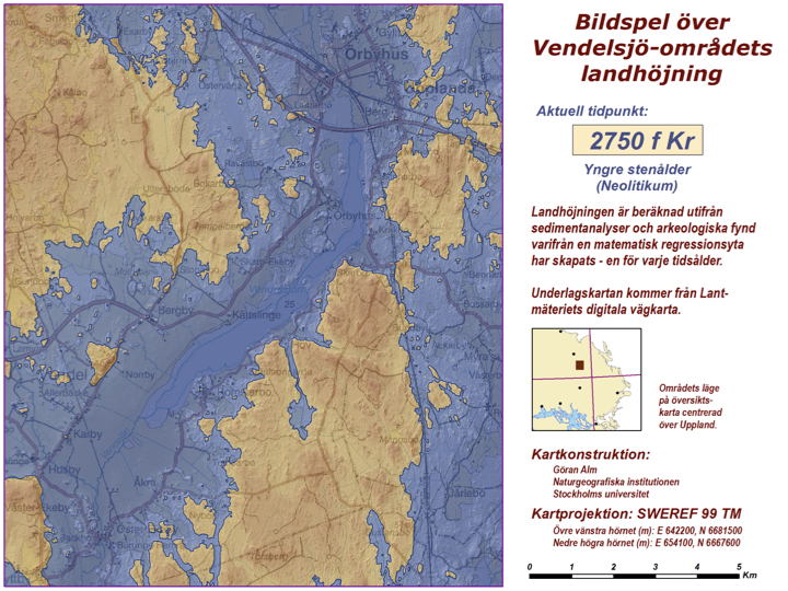
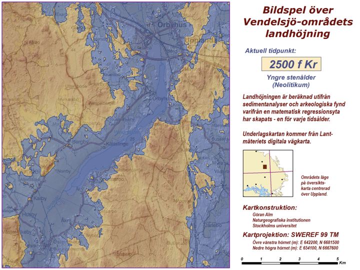
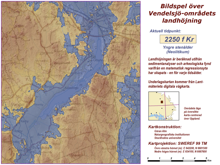
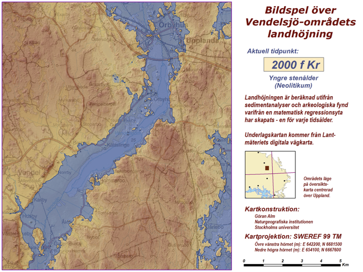
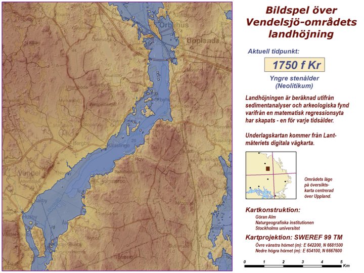
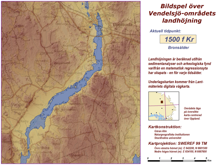
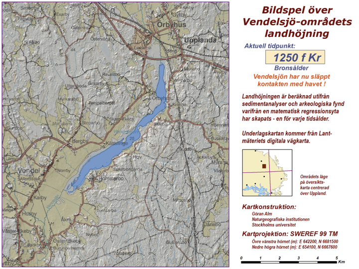
Bildspel över Vendelsjöområdets landhöjning 4000 – 1250 f Kr
Landhöjningen är beräknad utifrån sedimentanalyser och arkeologiska fynd varifrån en matematisk regressionsyta har skapats – en för varje tidsålder.
Kartotna har konstruerats av Göran Alm, Naturgeografiska Institutionen vid Stockholms Universitet.
![](https://www.vendelsjon.se/wp-content/uploads/2022/02/Vendelsjon2.001.jpeg)
![](https://www.vendelsjon.se/wp-content/uploads/2022/02/Vendelsjon2.002-1-1.jpeg)
![](https://www.vendelsjon.se/wp-content/uploads/2022/02/Vendelsjon2.02-2-1.jpeg)
![](https://www.vendelsjon.se/wp-content/uploads/2022/02/Vendelsjon2.005-1.jpeg)
![](https://www.vendelsjon.se/wp-content/uploads/2022/02/Vendelsjon2.006.jpeg)
![](https://www.vendelsjon.se/wp-content/uploads/2022/02/Vendelsjon2.007-1.jpeg)
![](https://www.vendelsjon.se/wp-content/uploads/2022/02/Vendelsjon2.008-1.jpeg)
![](https://www.vendelsjon.se/wp-content/uploads/2022/02/Vendelsjon2.009.jpeg)
![](https://www.vendelsjon.se/wp-content/uploads/2022/02/Vendelsjon2.010-1.jpeg)
![](https://www.vendelsjon.se/wp-content/uploads/2022/02/Vendelsjon2.011-2.jpeg)
![](https://www.vendelsjon.se/wp-content/uploads/2022/02/Vendelsjon2.012-2.jpeg)